Showing posts with label Motorcycle Trips. Show all posts

Saturday, August 17, 2013

Some times you just need a really long day in the saddle...

One of the problems I've become all too aware of since buying a motorcycle is that I tend to get very antsy the longer I go between long motorcycle rides. Not just antsy, either; moody, depressed, just off. The hardest part about this year was the fact that I got a very part-time job (Saturdays only) at my local motorcycle shop, helping out in the parts department. While working in a motorcycle store is awesome, it seriously cut into my riding time this year. I really started to feel it going into the beginning of August.

That said, I was also told that, as of August, I was not to assume that I should be coming in on Saturdays at the store anymore.

Which meant that, today, Saturday August 17th, there was a perfect alignment of a completely open Saturday with absolutely fantastic weather. And how did I choose to spend this day? Riding up VT Route 100.

11 hours, ~450 miles, 10 gallons of gasoline.

And what do I get in return? Stress relief, stunning views of the Green Mountains, and various sore body parts. All told, the soreness is a fair trade for everything else.

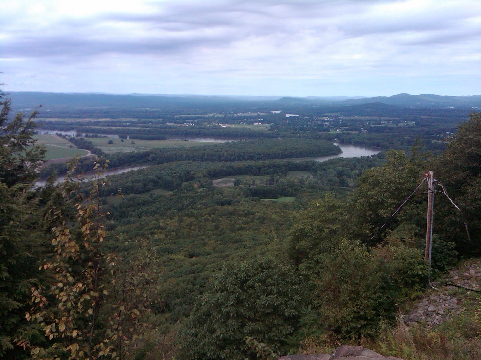
I started out by heading west on Route 2 to get to Shelburne Falls, MA to take 112 north. It runs right into VT 100 in the very bottom of the state. From there, I just followed VT 100 north. Granted, there came a point were I was having way too much fun and I completely missed the turn I needed to continue on VT 100 and found myself on VT 30. It was a mistake that was easily corrected by heading east on VT 11 towards Londonderry, VT.

It also afforded me a chance to get a snapshot:


Unfortunately, I didn't get many more pictures since I was, as I said, really enjoying the twisties.

Anyway, once I hit Waterbury, VT, I figured I had gone about as far north as I could for the day, so I headed back via I-89 and I-93. That part alone was almost 4 hours. That said, I-89 through VT is some of the prettiest Interstate in New England, if not the North East. It cuts through the mountains all the way until Lebanon, NH.

I'm definitely going to do it again, but I really want to get to the Canadian border next time. This will probably necessitate a camping trip to make it worthwhile.

Anyone up for a camping trip to northern Vermont?

Catch you later!


P.S. Because I have to do this every time I go out:


Saturday, August 3, 2013

A Preferable Kind of Madness

I gave up any hope of living a "normal" life many years ago. Chance are, I never had a hope like that to begin with. So, when I talk about the random goings-on in my life, the preferable bias in any given situation is that most normal people wouldn't approach it the same way. Take, as an example, the dessert I prefer for my birthday. Cake is good, pie is good, but what I really want is the mashed sweet potato with streusel topping my mother usually reserves for Thanksgiving and Christmas. If you've ever had it, you'd agree with me.

On to the topic at hand. Over the last few weekends the weather has not been entirely conducive to going out on motorcycle rides. Given that I rely on these rides as a significant piece of the foundation of my mental health, one can readily imagine that I was close to snapping. Well, as luck would have it, the forecast for this weekend was looking OK. Not fantastic, mind you, but passable. And for reasons beyond my understanding, my brain decided that it absolutely had to watch a sunrise.

(It probably has to do with this video.)

So, I did exactly what my brain told me to do. I planned on riding out to the Cape to watch the sunrise. I picked a spot (that was not open), and set my alarm clock to wake up with enough time to get there (I overslept).

I wanted to see the sunrise from the Nauset Light Beach. It's right on the water. However, the area is closed from Midnight to 6am (curses!).

Still, despite leaving 40 minutes later than I wanted, I still made good time, so I was able to find a secondary location; Fort Hill, just down the road from the Nauset Light. I arrived around 4:30 or so to this view:


It gradually lightened over the next 45 minutes to give this view:


I stayed to watch the sunrise. Despite the haze (calling it "humid" would be a disservice. "Damp" works better), and the clouds, the view was gorgeous. I tried to take a picture or two, but because I lacked a decent camera at the moment (a digital SLR, or film for my 35mm SLR), they were horrible. Believe me, though, it was a sight, and well worth the hour-and-a-half nap I took when I got home. I left just after the sun came up. On the ride home, as I got off of the Cape, the clouds started to roll back in, so it was pretty grey when I pulled back up in front of my apartment. Still, I enjoyed the trip.

I just have to remember to plan better next time so that I do more than just see a sunrise then brow-beat myself back home to take a nap.

Anyway, here's a picture of Meliora in her "day trip" configuration in as picturesque a setting as I can get with an iPhone's camera:


Catch you on the flip side!

Thursday, December 29, 2011

New adventures in Planning Madness

And if you can make any sense out of that title, you're doing better than I am.

I started another blog ("Another one!?  What are you thinking?") in an effort to do two things: 1) Keep track of my preparations for my motorcycle trip this year and 2) to have some guidelines of all the preparations and supplies needed in case I decide to try this lunacy again in the years hence.

It also helps me sort things through.  When I first decided to go on this trip to the Beartooth Highway, I didn't really have all of the logistics in my head.  Mostly what I was thinking, if I was really thinking at all ("How is that different than normal?"  Shut up, brain), was how cool it would be to ride across country and see the Rocky Mountains; logistics, planning, and all of the "boring" aspects didn't really enter my head until I started actually looking at the map and how long it would take to get there.  It was shortly thereafter that I figured two weeks worth of vacation would be plenty of time to see the multiple locations I wanted to visit (Seriously, trying to go down the Blue Ridge Parkway, then over to the Beartooth Highway, then around to the Utah Patchwork Highway in 14 days is doable, right?  Over 6,000 miles should be a cake walk!).  Given that I've never actually done this kind of thing before, and assuming I could ride 10+ hours a day, that seemed reasonable.

Then I received a jolt.  I decided during the summer to try and see exactly what I could handle on a motorcycle.  6 hours on an uncomfortable seat just about did me in.  I was sore for a day or so afterwards.  I knew then that I needed to change my thinking a little bit.

First off, I decided that such a trip should not be attempted by someone like me on an 800cc cruiser.  Not necessarily because the engine isn't up to the task, but because a bike that small would be challenging to deal with riding all day.  Secondly, having to quickly ride through areas without being able to really enjoy them didn't seem all that appealing, and I wanted to be able to savor this experience.  Thirdly, coming to grips with what would actually be required to pull this off smacked me upside the head when I roughly calculated just the cost for fuel alone.

In the end, I discarded every other location I had set for myself so that I could focus on the one place I really wanted to see.  I've dreamed of seeing the Rocky Mountains (I've seen them from the air, but that really doesn't count) and this has become part of that.  The fact that I want to do it on a motorcycle?  That, in my mind, seems to be a given.

As I mentioned to one of my friends, if it wasn't a challenge, it wouldn't be as rewarding an experience.  To quote one of my favorite movies, out of context, "if it was easy, everyone would do it.  Being hard is what makes it great."

Sunday, October 16, 2011

Dana, Massachusetts and Riding Gap

Despite the order described in the title, I'm actually going to talk about the "riding gap" and its consequences first.  Why?  Because I want to get the bad out of the way before I talk about the good.  Although, to do that properly, I also have to mention the repercussion of my rash actions today, but I suppose that particular set of poor choices is easier to talk about in context.

Anyway, so the "riding gap" that I above refer to, has to do with getting back on a motorcycle after roughly two weeks without a long ride.  Sure, a few short jaunts here and there, but nothing like my previous motorcycle trips.  Well, as it turns out, when you haven't ridden in a few weeks, and you climb back on a bike and decide to ride for 6 hours, it really does a number on you.  I am, and this is not really an exaggeration, sore all over.  My back, backside, arms, neck, feet, all of it.  So very sore...

That said, it was and absolutely gorgeous day to ride today.  Despite the chill in the air (especially felt on a motorcycle with no windshield), the sun was out and shining, and the roads I picked were in spectacular shape.  I would have to say that, within a margin of error, today was possibly the best ride yet.  Really for two reasons:

1) I got to check off another ride from the list.  I rode out to Dana, MA and got to walk around the remains of the town a little bit.  I certainly didn't spend enough time there, and I have to go back, preferably with better shoes to wear.

2) I was on my motorcycle for the first time in weeks and it was a perfect start to my vacation.

I also happened to take more pictures on this trip than I have for any of the others.  To try and describe them all would be a waste, as they are all, basically, of the same 500 foot radius around the site of Dana Common.  However, they are very beautiful pictures, so I will post them anyway.


It reads:
SITE OF DANA COMMON
1801 - 1938
To all those who sacrificed their homes and way of life
(Erected by Dana Reunion 1996)


So, the entrance to Dana, MA is along MA-32A.  It's about 1.8 miles down the old road from the gate that the Department of Recreation and Conservation put up.  The entire walk was very nice.  It was tree lined most of the way, breaking in spots were a particular house and property once stood.  In a few spots, the trees thinned and I could see a nearby pond set back in the woods.  One of the most amazing features is the remains of extra roads that you would normally see in any small town, branching out from the main road.

As I got closer to the Common, the amount of forest along the roads receded and the number of old foundations increased.  The Common itself looks well cared for, as the DRC keeps it more or less taken care of.  It has a distinct feeling of being lonely, though.  As if the area around the common is just waiting for people to come back home.  However, I did find it peaceful otherwise.  It would be a hell of a place for a picnic.

When it was time to head back to the bike, my feet were starting to hurt.  Here's the equation:
Chippewa Logger Motorcycle boots + top-grain cowhide chaps + 3.6 mile hike = Sore feet and a massive blister.

I had to chant a cadence to myself to keep going on the way back.  It wasn't as fun as I would have wanted.

That said, the next time I go, I'm bringing my motorcycle bag and a pair of sneakers.  I wish I had a better camera to use as well.  Still, all things considered, it was pretty awesome.

After getting back to my bike, I then headed up to the Quabbin Tower in what used to be Enfield, MA.  It has a magnificent view of the Reservoir and the surrounding area.  With the sky as clear as it was today, I could see all the way to Mt. Monadnock in New Hampshire.  After that, I climbed back on the bike and headed home.

I went a slightly different route today.  I was getting a little tired of 117 to 110, and Clinton, MA is a shithole to begin with.  So, I went out US-20 to MA-27, then to MA-62, MA-70, MA-140, then I took Goodale St to MA-31, to MA-122, to MA-32/32A, to 32A.  From that turn, it was 3.1 miles to the entrance to the road to Dana.  After that, I pretty much backtracked.  It was a decent ride, with some nice twisties and a few places to really open the bike up.  It was a magnificent return to the saddle.

Monday, September 19, 2011

Group Rides and Cold Weather

On my previous trip, I went for a scouting ride out to Mt. Holyoke in South Hadley, MA.  The start of that ride was a little chilly, but it quickly warmed up and was an absolutely gorgeous ride.  I got turned around, once or twice, but nothing too big.  And, the biggest part, I did it alone, in anticipation of leading a group of 8 other riders along the same route.  After a decent ride, I felt confident in the route (both out and back), and there wasn't a turn that I would get lost on.  That part I was confident about.

Leading a ride, with seven other bikes?  That made me nervous.

I was nervous about it, up to the morning of, when I realized I had forgotten to print out copies of the map for the others.  I had to fix an issue at work that morning, so I decided to kill two birds with one stone.  It wasn't a big issue (on either count), and I was quickly on my way to the meetup starting point.

Side note: my bike hates starting in the cold.  It was a good five minutes of cussing, swearing, and repeated attempts to start the bike before it finally kicked over.  Once she warmed up, though, she was right as rain.

I must say, it was far colder this weekend than any other I've ridden.  Even after putting the liner back in my riding jacket and closing the sleeves, I was still freezing.  Definitely a case to be made for buying a new windshield for the bike.  I liked the one the bike came with, but, it was damaged when I tumbled.  I think it's a good thing, though, since I would definitely like to get one with a quick-release mount.  I also need better cold weather riding gloves.  It's not quite so easy riding with near-frozen fingers.  Chalk this one up to lessons learned about riding.

The route was just as easy to ride this time as it was the last time; with two exceptions.  There was a bit more traffic in Amherst than the first time, and they were paving part of the route on 117.  I think, however, that being lost and turned around a few times is worse than having to deal with a little traffic and some road work, so I think it all balances out.  There were a few views that were definitely better, this time around, given that there wasn't as much cloud cover as last time.  Mostly the views on 202 and the top of Mt. Holyoke were far better, and the rest of the trip was nicer overall.

As it turned out, only two other people showed up for the ride, both of them experienced in group riding.  This helped, a lot.  Plus, with only two other people, it helped calm me down for the trip.  They knew what they were doing, and I could focus more on actually learning the ropes on how to lead; when to signal, the best spots for single-file vs. staggered formation, and generally keeping an eye on road conditions.  I would be lying if I said I wasn't nervous at all.  But, by the time we reached out lunch stop, most of the gitters were gone and the rest of the ride went much more smoothly.

Second side note: I scraped my first peg on one of the switchbacks heading up the road to the summit of Mt. Holyoke.  The rider right behind me, Brenda, told me she thought she saw sparks.  The best part, I didn't panic, and was able to complete the turn without a problem.  Coming down was a little more sloppy; I need more brake control practice.

When all was said and done, both the other riders complimented me on a "job well done" for leading the ride as well as I did.  It helps to know that I'm good enough at it that I can lead future rides without too many problems.  Hopefully I won't be nearly as nervous next time.

Sunday, September 11, 2011

My Scouting Trip

For the past several months I've been planning a trip to Mt. Greylock in Western Massachusetts.  It's right outside a town called North Adams, and partially forms the border between Massachusetts and New York.  It's also the highest elevation in the Commonwealth and I've heard the view is rather spectacular.  Back when I first created the meet up (thanks, Meetup.com), it was me and one other dude.  Then, about two months ago, it went from two of us, to eight of us.  Now, I will admit, I hadn't really thought through exactly what I was doing when I posted the ride.  I figured at most 3 other people would join me.

Well, such as it is, I now have to lead a group of 8 riders on a trip of some 150 miles, or so.  This, let me tell you, freaked me out to no end.  I scrambled to find someone to help me.  Enter Brenda.  She was very kind enough to lend me her expertise (she's led many rides herself), and she has offered to be the co-captain of the trip.  Whew!

As luck would have it, things didn't stop there.  This weekend, when I was hoping to ride out to Greylock, to test the trip for myself and make sure that I could plan what I needed to do (such as where it would be necessary to ride single-file as opposed to staggered), Brenda told me that the primary route I was hoping to take was closed, due to road damage caused by hurricane Irene.  On further investigation, I uncovered information that several of the routes to Mt. Greylock had also been damaged.

Rather than scrap the ride, I decided to change the route and destination.  On Brenda's suggestion, I looked at a ride to Mt. Holyoke.  With a basic map in mind and a starting route pretty much on the books, I decided that I would ride the new route, to the new destination.  Man, there were some amazing pieces of road, both in scenery and in the amount of curves involved.

Along US-202, I came across a scenic overlook, of sorts.  If offered me my first-ever glimpse of the Quabbin Reservoir.

Needless to say, I had to stop and take the above picture.


So, I continued on, taking a right at Amherst Road and continuing on.  Most of this portion was fairly unassuming.  Nothing too big, except, I ran passed lunch time again, so as I made a few mistakes, and had to search for an ATM, I was getting a little cranky.  Still, I finally made it to my destination for the day.  From the summit (a whopping 932 feet), there was a very nice view of the surrounding area, including the Connecticut River.

This is from the north "face" of Mt. Holyoke

Another north "face" picture

Last north "face" picture.  That's the Connecticut River running below.

The next pictures are all from the south "face"


Summit Cap


It was an impressive view.  I can only imagine how much better the view from Mt. Greylock is.  The cool thing about Mt. Holyoke is the access road to the summit.  It's a perfect training road for getting used to switchbacks on a bike.  I will admit, quite readily, that I have quite a way to go before I can handle the big boy switchbacks that exist elsewhere.  Still, it was a lot of fun trying them out.  I just have to learn the lines better and not be quite as scared to lean the bike over.

On a sour note, I noticed that the left front foot peg is rather damaged.  Rather than try and hobble it together for the trip next weekend, I decided I'd just order some replacement pegs (and pegs that aren't made of bad carbon steel and rubberized plastic).  When I got back, I placed and order for a new set of Arlen Ness front foot pegs.  Why Arlen Ness?  Because I really don't feel like having the foot spikes (they aren't really pegs at that point) and I wanted a set of pegs to match the passenger pegs.

Pictures of the pegs once I get them installed.

All things considered, I hope the ride next weekend goes off without too many bumps.  And, despite my earlier trepidation, I would like to see the other riders come along.  It'll be fun.

Sunday, September 4, 2011

New Seat Coming and Group Rides

I was finally able to get my bike from my sister's house in Danbury, CT yesterday.  Coming back was a beautiful ride.  It was a little chilly starting out, so I threw on my jacket, and near the end it started to get a little overcast, but nothing really came of it.  To top it all off, it didn't take anywhere near as long as I thought it was going to take, given the amount of time it took me to get down there.  The icing on the cake was the fact that I wasn't anywhere near as sore as I was on the trip down.

Still, I'm getting a better seat for the bike.

Or, I should say, I ordered a better seat for the bike and now I'm waiting for it to come in.  According to UPS, the new seat should arrive on Sept. 8th; which means that I will be able to break it in that weekend when I ride the route for my group ride on the 17th.  (I'll post more about the seat, and some pictures, after I've installed it.)  Hopefully I'll be able to get someone to come with me, so that I can test it out in a "group ride" situation.

Speaking of; I had a good ride today (not great, since it didn't last that long).  I met up with another member of the Wetrowest Riders group I'm a member of.  Brenda was experienced leading group rides: me not so much.  She offered to teach me the ropes so that I'd be ready for the 17th ride to Mt. Greylock.  We met up for breakfast in Arlington, then headed out Rt. 117 for a bit so I could get a feel for leading rides.  Overall, she seemed to think I did all right.

I'm still nervous about the ride, since I have to do a lot more planning (this is an object lesson in riding the route far in advance of the actual ride, several times, so as to not be as nervous about the route), but I should be ok to lead the trip, particularly if Brenda gets a friend of hers to come along who has a headset, and can ride sweep.

Note: For those who are unfamiliar, a "Sweep" is the last rider in a group, and is the one who makes sure to keep the stragglers from getting lost or separated from the group.

As I do not have communications gear yet, and I have to lead the ride, Brenda has offered to be a relay rider to communicate with the sweep rider and let me know when the sweep has everyone rounded up if we have to stop for some reason.  That alone makes me feel better.

The two last major pieces of setup I have to do:
1) Figure out all of the stops that we will need to make and communicate them, and some basic instructions, to the rest of the riders in the group
2) Prepare a small prep talk for the day of the ride so everyone is on the same page.

This should be a blast.  I can't wait.

Monday, August 15, 2011

Long Trip to CT

Wow, who would have thought that a route that's supposed to take only 4 and a half hours would actually wind up being closer to 6?  Actually, you tell anyone that you are taking an untested route and that's pretty much an expected outcome.  I, at the very least, figured that it would be a lot more straightforward, what with a crazy assumption that road signage would be sufficiently posted along the route.  A minor inconvenience, in the grand scheme of the trip, but enough to cause my ire to rise up more than once; that and I, basically, forgot to get lunch.

Here's the equation: Low Blood Sugar + Inadequate Signage + Doubling back twice = Irate Capt. Croton

Or somesuch.

Anyway, irritations aside (and out of the way.  Best to purge the bad so as to focus on the good) the trip was beautiful.  There were many points in the ride that led to muffled "wows" in my helmet.  Along route 20, in Massachusetts, there were some breathtaking scenes once I got past Marlborough.  The road heads up into the hills and the scenes usually presented themselves once cresting the hills.  There was, however, one part of the trip that just left me dumbfounded.

A few miles outside of Sturbridge I road through the path of the tornado that touched down a few months ago.  The damage it left behind was almost unbelievable.  I thought, at first, that some company had decided to clear the trees, but then I later realized what it really was and I was shocked.  What really hit me was how massive an area it ripped up.  You don't think of tornadoes as being necessarily that wide, but from the start of the destruction to the end of it (along the road) was a good one half/three quarter mile.

I then made it to Sturbridge.  It's a very pretty town, and the main portion of it, once you get past the malls and similar just outside of it, has some very nice houses in it.  Shortly thereafter, I turned down route 19, heading into CT.  Now, by the time I reached 19, I had been riding for, oh, 45 minutes or so.  There were a fair number of stop lights along 20 and there were some very advantageous gas stations to stop at, should I had an urge to stop and rest for a minute before continuing.  19, on the other hand, would exemplify much of the rest of the trip.  Long stretches of road with nowhere to stop, and no stop lights to stand up quickly to stretch your legs.  That said, at this point in the trip, I hadn't been on the bike very long, so I didn't make too much of it.

19 passed through some very beautiful country.  A lot of tree shade on the road and some rather scenic ponds made it particularly nice to ride through.  19 turned onto 319, then from 319 I turned onto 190.  Most of this piece was through towns and a large shopping mall area that really weren't all that interesting.  After turning onto 159, however, things became interesting (if you can call yelling at the state of Connecticut, to yourself, inside your helmet, about the abhorrent lack of road signage "interesting").  While searching along 159 for 168, it suddenly dawned on me that my trip would not go quite as smoothly as I had originally hoped.

I stopped in a town called Windsor Locks, looking for someone who could point me the right direction, but no such individual was to be found.  It was quite disappointing.  Riding on down the road a little further, I almost hopped on I-91 south to get to I-84, but, my sense of... pride?  Stubbornness?  Masochism? pushed me forward to trying to find the correct route, dammit!

Well, I never did find 168, or and of the true back roads I wanted to take (particularly 219, which is a shame because it cuts right through a state forest and down past a large reservoir), but I did find US 202.  Once I got on that, I knew I was going to be okay.  That, having found 202, and the fact that it would take me almost directly to Danbury, made me feel a little better.  I finally was able to stop and get gas (just over 60mpg.  Eat it, Prius!) and grab a sandwich (that whole malarkey about low blood sugar) and I realized that it would only get better.

Enter Torrington, CT.

US 202, being a US Highway that existed prior to the current Interstate Highway system, was, in my mind, a rather major route that runs through most of New England.  The only New England state that it doesn't run through is Rhode Island, other than that, it winds its way from New York, through Connecticut, up through Massachusetts and into Vermont before turning again and running through New Hampshire and ending in Maine.  This, to me, seems like a road that would have something resembling appropriate markings to let you know when you are on it.  And, in many places, this is the case.  Not so much in Torrington.  Nope, Torrington decided that the best thing to do was to make it as least clearly marked as possible, particularly at the ambiguous intersections that somehow litter the town.  All I have to say on this matter is that my blood pressure was not having the best of days.

Again, despite these issues, the ride was gorgeous.  Both Massachusetts and Connecticut have beautiful stretches of roads once you get away from the major population areas.  The western halves of both states have hills and valleys covered in trees which offer some truly impressive scenery.  It's definitely a trip I would like to make again.  The only change I would make, is to put sunscreen on.  I've got a pretty impressive "biker's tan" going on.  Except, I'm a pale Irish dude, so it's more a "biker's burn."

I wish I had pictures, but, alas, I stowed my cellphone in my luggage pack and didn't feel like rummaging around for it constantly.  The next time I take the trip I'll keep it (or an actual camera) closer at hand.

Saturday, June 4, 2011

Gloucester Trip

Another trip down.  So far, each trip has been a learning experience.  This time, I learned that my bike, specifically the seat on my bike, is absolute trash for highway riding.  Every vibration goes straight into my behind and causes this very dull, constant ache.  I know it was the highway, because as soon as I got off on Trapelo Rd, the pain went away.  It was impressive.

Now that I have that particular TMI moment out of the way, on to the trip.  Today was a little chilly, and I definitely noticed it while on I-95 and 128 while heading up to Gloucester.  That, and it was incredibly frightening at first.  The roads, far from smooth, weren't too bad, but the constant breeze pushing my bike around meant that I spent a lot of effort keeping the bike going straight.  Still, once I hit 128, I had basically gotten the hang of riding at highway speeds, so it wasn't as bad.  The upshot of this particular fear-inducing type of riding is that riding on back roads is no longer as frightening as it once was.  You still have to be on the lookout for assholes who think you don't exist, but that's part of riding.

The impetus for this particular trip was that I was dying for good seafood.  And what better place than Gloucester?  I found this small place (that was rather hard to find, once I got there.  And I was on foot at that point) called the Halibut Point Pub.  They had this deal for a cup of chowder, a burger, and a draft beer for $17.  The burger was awesome, but the chowder was "homemade" and one of the best clam chowders I've had in a while.

Still, I couldn't go and not take a few pictures.  Walking around afforded me the following:

 That building in the distance is the City Hall.  The picture doesn't really do it justice.  It was impressive.

The Sargent House museum...  Yeah.


These pictures are of the Fitz Henry Lane house and grounds.  It overlooks Gloucester Harbor.  The view is not quite as impressive now as it would have been at his time.


Can't go to Gloucester and not see the Man at the Wheel.  There was a large group (as you can probably see) standing near it, so I didn't get too close.  But, it is on a very beautiful seascape (as you can see in the picture above it).

For the trip back I spent most of my time on Route 127.  It runs, more or less, parallel to 128, but is far more scenic and opens out into several breathtaking views of the ocean.  Unfortunately, it's difficult to get pictures from a moving motorcycle, so I will have to go back with a better camera and my car.

Still, I had a great day on my bike.  It's supposed to be crappy tomorrow, so I'm glad I got a nice long ride in.

Catch you all later!

Saturday, May 21, 2011

Wachusett Reservoir and the Old Stone Church

After too many days straight of rain, and yesterday being my first chance to hop on my bike for those many days, I decided to make today a day for a motorcycle trip.  Knowing that I would probably talk myself out of actually doing anything remotely like that under normal circumstances, I decided I was just going to do it, possibility of rain be damned.

The day started out simply enough.  The part to fix my bike had arrived at the dealership, so my first stop was in Arlington, to get my bike fixed.  It took longer than I had hoped, but not quite as long as it could have taken.  I got there around 10:30 and was back on the road by 12:45 or so.

I made a swing by Sam's apartment, to see if she wanted to do anything (like I said, I was probably looking for a way out), but the fates had decreed that she be at a concert in Boston.  Ok, no big deal.  I had pretty much decided to head out by that point, so I just got back on my bike and headed for route 117.

I stopped for a bite to eat (mmmm... falafel) and looked somewhat apprehensively at the sky, but there was so much sunlight, and the clouds looked rather far off.  I munched away, sitting next to my bike, thinking about how long it would take and whether or not I would have to refuel at all.  I had just filled up the day before, so I had a full tank as I set out on my trip.

I have two things to say, right up front.  Weston needs to fix their goddamn roads, and there were a lot of other riders out today.

First off, 117 through Weston and Concord sucks ass.  I heard from the shop where I stopped in on my way back (same shop I had lunch at) that they were planning on repaving it this summer.  This is a good thing, as trying to take a curve on a shitty road on a motorcycle is *not* a good time.  Otherwise, the ride out to the Reservoir was very nice.  It was a beautiful day to ride and the sun never went anywhere the entire trip.

It was, however, a longer trip than any I had taken up to that point.  My butt was, I thought, going to fall off by the time I reached the Reservoir.  Oh boy, I hadn't felt anything yet.  Still, the first place I stopped at offered me a chance to relieve myself and treated me to this view:


It was then I talked to two very nice people who were able to direct me to the Old Stone Church (one of the entire reasons I wanted to take this particular trip).  Not more than two miles later, I came across the church. It was off the main roadway and there were quite a few people around.

After stopping just long enough to curse at my transmission for flatly refusing to enter first gear, I made it to the church.  It's quite a site from the roadway, but I couldn't get a very good shot with my camera from a distance.

So, I walked in on foot (you have to, anyway, since the path up to it is gated).  It's a very peaceful spot, I must say.


The church has been gutted (thanks to two fires and the MWRA), but has interior supports that were added to keep the walls from collapsing.  The bell tower is also empty (save for a lone pigeon):


As I looked around the area, it struck me how really beautiful the location is.


As you can see, it's a hell of a view.  That last picture, though, and the gathering dark clouds, convinced me that I should start making my way home.

I headed back to my bike and had a relatively worry-free trip home.  The only problem I encountered on my way back: if I thought my ass hurt on the way to the reservoir, the trip home made me want to kill myself more than once.  Unlike a car, there isn't a lot you can do to shift your position.  By the time I made it back into Weston, to the store I stopped at earlier, to get a sandwich, my back was hurting.  The condition of the road did nothing to help, as going over the rough pavement was hellish.

So, I picked up some ibuprofen while in the store, and another drink and a small sandwich (mmmm... falafel), I let my butt recuperate a little bit before finishing the trip.

I did come to a realization today.  First, while I was sitting in the waiting area of the service department at the dealer, I had a rather long and interesting conversation with the other guys waiting around for their bikes.  It didn't matter what kind of bikes we rode, just that we rode them.  Second, while I was having my lunch, I was sitting outside, next to my bike.  One of the other guys in the store came out and, as he was getting into his truck, complimented the bike.  Last, with very few exceptions, almost every guy I passed on a bike either waved first, or returned my wave (and they aren't your typical wave, either).  I have become one of them, a biker.  One of those guys in the "fraternity" who, just by owning a bike, has become part of that culture.  It's pretty cool.

Catch you all later!