I gave up any hope of living a "normal" life many years ago. Chance are, I never had a hope like that to begin with. So, when I talk about the random goings-on in my life, the preferable bias in any given situation is that most normal people wouldn't approach it the same way. Take, as an example, the dessert I prefer for my birthday. Cake is good, pie is good, but what I really want is the mashed sweet potato with streusel topping my mother usually reserves for Thanksgiving and Christmas. If you've ever had it, you'd agree with me.
On to the topic at hand. Over the last few weekends the weather has not been entirely conducive to going out on motorcycle rides. Given that I rely on these rides as a significant piece of the foundation of my mental health, one can readily imagine that I was close to snapping. Well, as luck would have it, the forecast for this weekend was looking OK. Not fantastic, mind you, but passable. And for reasons beyond my understanding, my brain decided that it absolutely had to watch a sunrise.
(It probably has to do with this video.)
So, I did exactly what my brain told me to do. I planned on riding out to the Cape to watch the sunrise. I picked a spot (that was not open), and set my alarm clock to wake up with enough time to get there (I overslept).
I wanted to see the sunrise from the Nauset Light Beach. It's right on the water. However, the area is closed from Midnight to 6am (curses!).
Still, despite leaving 40 minutes later than I wanted, I still made good time, so I was able to find a secondary location; Fort Hill, just down the road from the Nauset Light. I arrived around 4:30 or so to this view:
It gradually lightened over the next 45 minutes to give this view:
I stayed to watch the sunrise. Despite the haze (calling it "humid" would be a disservice. "Damp" works better), and the clouds, the view was gorgeous. I tried to take a picture or two, but because I lacked a decent camera at the moment (a digital SLR, or film for my 35mm SLR), they were horrible. Believe me, though, it was a sight, and well worth the hour-and-a-half nap I took when I got home. I left just after the sun came up. On the ride home, as I got off of the Cape, the clouds started to roll back in, so it was pretty grey when I pulled back up in front of my apartment. Still, I enjoyed the trip.
I just have to remember to plan better next time so that I do more than just see a sunrise then brow-beat myself back home to take a nap.
Anyway, here's a picture of Meliora in her "day trip" configuration in as picturesque a setting as I can get with an iPhone's camera:
Catch you on the flip side!
Showing posts with label Trip Pictures. Show all posts
Saturday, August 3, 2013
Sunday, October 16, 2011
Dana, Massachusetts and Riding Gap
Despite the order described in the title, I'm actually going to talk about the "riding gap" and its consequences first. Why? Because I want to get the bad out of the way before I talk about the good. Although, to do that properly, I also have to mention the repercussion of my rash actions today, but I suppose that particular set of poor choices is easier to talk about in context.
Anyway, so the "riding gap" that I above refer to, has to do with getting back on a motorcycle after roughly two weeks without a long ride. Sure, a few short jaunts here and there, but nothing like my previous motorcycle trips. Well, as it turns out, when you haven't ridden in a few weeks, and you climb back on a bike and decide to ride for 6 hours, it really does a number on you. I am, and this is not really an exaggeration, sore all over. My back, backside, arms, neck, feet, all of it. So very sore...
That said, it was and absolutely gorgeous day to ride today. Despite the chill in the air (especially felt on a motorcycle with no windshield), the sun was out and shining, and the roads I picked were in spectacular shape. I would have to say that, within a margin of error, today was possibly the best ride yet. Really for two reasons:
1) I got to check off another ride from the list. I rode out to Dana, MA and got to walk around the remains of the town a little bit. I certainly didn't spend enough time there, and I have to go back, preferably with better shoes to wear.
2) I was on my motorcycle for the first time in weeks and it was a perfect start to my vacation.
I also happened to take more pictures on this trip than I have for any of the others. To try and describe them all would be a waste, as they are all, basically, of the same 500 foot radius around the site of Dana Common. However, they are very beautiful pictures, so I will post them anyway.
So, the entrance to Dana, MA is along MA-32A. It's about 1.8 miles down the old road from the gate that the Department of Recreation and Conservation put up. The entire walk was very nice. It was tree lined most of the way, breaking in spots were a particular house and property once stood. In a few spots, the trees thinned and I could see a nearby pond set back in the woods. One of the most amazing features is the remains of extra roads that you would normally see in any small town, branching out from the main road.
As I got closer to the Common, the amount of forest along the roads receded and the number of old foundations increased. The Common itself looks well cared for, as the DRC keeps it more or less taken care of. It has a distinct feeling of being lonely, though. As if the area around the common is just waiting for people to come back home. However, I did find it peaceful otherwise. It would be a hell of a place for a picnic.
When it was time to head back to the bike, my feet were starting to hurt. Here's the equation:
Chippewa Logger Motorcycle boots + top-grain cowhide chaps + 3.6 mile hike = Sore feet and a massive blister.
I had to chant a cadence to myself to keep going on the way back. It wasn't as fun as I would have wanted.
That said, the next time I go, I'm bringing my motorcycle bag and a pair of sneakers. I wish I had a better camera to use as well. Still, all things considered, it was pretty awesome.
After getting back to my bike, I then headed up to the Quabbin Tower in what used to be Enfield, MA. It has a magnificent view of the Reservoir and the surrounding area. With the sky as clear as it was today, I could see all the way to Mt. Monadnock in New Hampshire. After that, I climbed back on the bike and headed home.
I went a slightly different route today. I was getting a little tired of 117 to 110, and Clinton, MA is a shithole to begin with. So, I went out US-20 to MA-27, then to MA-62, MA-70, MA-140, then I took Goodale St to MA-31, to MA-122, to MA-32/32A, to 32A. From that turn, it was 3.1 miles to the entrance to the road to Dana. After that, I pretty much backtracked. It was a decent ride, with some nice twisties and a few places to really open the bike up. It was a magnificent return to the saddle.
Anyway, so the "riding gap" that I above refer to, has to do with getting back on a motorcycle after roughly two weeks without a long ride. Sure, a few short jaunts here and there, but nothing like my previous motorcycle trips. Well, as it turns out, when you haven't ridden in a few weeks, and you climb back on a bike and decide to ride for 6 hours, it really does a number on you. I am, and this is not really an exaggeration, sore all over. My back, backside, arms, neck, feet, all of it. So very sore...
That said, it was and absolutely gorgeous day to ride today. Despite the chill in the air (especially felt on a motorcycle with no windshield), the sun was out and shining, and the roads I picked were in spectacular shape. I would have to say that, within a margin of error, today was possibly the best ride yet. Really for two reasons:
1) I got to check off another ride from the list. I rode out to Dana, MA and got to walk around the remains of the town a little bit. I certainly didn't spend enough time there, and I have to go back, preferably with better shoes to wear.
2) I was on my motorcycle for the first time in weeks and it was a perfect start to my vacation.
I also happened to take more pictures on this trip than I have for any of the others. To try and describe them all would be a waste, as they are all, basically, of the same 500 foot radius around the site of Dana Common. However, they are very beautiful pictures, so I will post them anyway.
![]() | |
| It reads: SITE OF DANA COMMON 1801 - 1938 To all those who sacrificed their homes and way of life (Erected by Dana Reunion 1996) |
So, the entrance to Dana, MA is along MA-32A. It's about 1.8 miles down the old road from the gate that the Department of Recreation and Conservation put up. The entire walk was very nice. It was tree lined most of the way, breaking in spots were a particular house and property once stood. In a few spots, the trees thinned and I could see a nearby pond set back in the woods. One of the most amazing features is the remains of extra roads that you would normally see in any small town, branching out from the main road.
As I got closer to the Common, the amount of forest along the roads receded and the number of old foundations increased. The Common itself looks well cared for, as the DRC keeps it more or less taken care of. It has a distinct feeling of being lonely, though. As if the area around the common is just waiting for people to come back home. However, I did find it peaceful otherwise. It would be a hell of a place for a picnic.
When it was time to head back to the bike, my feet were starting to hurt. Here's the equation:
Chippewa Logger Motorcycle boots + top-grain cowhide chaps + 3.6 mile hike = Sore feet and a massive blister.
I had to chant a cadence to myself to keep going on the way back. It wasn't as fun as I would have wanted.
That said, the next time I go, I'm bringing my motorcycle bag and a pair of sneakers. I wish I had a better camera to use as well. Still, all things considered, it was pretty awesome.
After getting back to my bike, I then headed up to the Quabbin Tower in what used to be Enfield, MA. It has a magnificent view of the Reservoir and the surrounding area. With the sky as clear as it was today, I could see all the way to Mt. Monadnock in New Hampshire. After that, I climbed back on the bike and headed home.
I went a slightly different route today. I was getting a little tired of 117 to 110, and Clinton, MA is a shithole to begin with. So, I went out US-20 to MA-27, then to MA-62, MA-70, MA-140, then I took Goodale St to MA-31, to MA-122, to MA-32/32A, to 32A. From that turn, it was 3.1 miles to the entrance to the road to Dana. After that, I pretty much backtracked. It was a decent ride, with some nice twisties and a few places to really open the bike up. It was a magnificent return to the saddle.
Sunday, September 11, 2011
My Scouting Trip
For the past several months I've been planning a trip to Mt. Greylock in Western Massachusetts. It's right outside a town called North Adams, and partially forms the border between Massachusetts and New York. It's also the highest elevation in the Commonwealth and I've heard the view is rather spectacular. Back when I first created the meet up (thanks, Meetup.com), it was me and one other dude. Then, about two months ago, it went from two of us, to eight of us. Now, I will admit, I hadn't really thought through exactly what I was doing when I posted the ride. I figured at most 3 other people would join me.
Well, such as it is, I now have to lead a group of 8 riders on a trip of some 150 miles, or so. This, let me tell you, freaked me out to no end. I scrambled to find someone to help me. Enter Brenda. She was very kind enough to lend me her expertise (she's led many rides herself), and she has offered to be the co-captain of the trip. Whew!
As luck would have it, things didn't stop there. This weekend, when I was hoping to ride out to Greylock, to test the trip for myself and make sure that I could plan what I needed to do (such as where it would be necessary to ride single-file as opposed to staggered), Brenda told me that the primary route I was hoping to take was closed, due to road damage caused by hurricane Irene. On further investigation, I uncovered information that several of the routes to Mt. Greylock had also been damaged.
Rather than scrap the ride, I decided to change the route and destination. On Brenda's suggestion, I looked at a ride to Mt. Holyoke. With a basic map in mind and a starting route pretty much on the books, I decided that I would ride the new route, to the new destination. Man, there were some amazing pieces of road, both in scenery and in the amount of curves involved.
Along US-202, I came across a scenic overlook, of sorts. If offered me my first-ever glimpse of the Quabbin Reservoir.
It was an impressive view. I can only imagine how much better the view from Mt. Greylock is. The cool thing about Mt. Holyoke is the access road to the summit. It's a perfect training road for getting used to switchbacks on a bike. I will admit, quite readily, that I have quite a way to go before I can handle the big boy switchbacks that exist elsewhere. Still, it was a lot of fun trying them out. I just have to learn the lines better and not be quite as scared to lean the bike over.
On a sour note, I noticed that the left front foot peg is rather damaged. Rather than try and hobble it together for the trip next weekend, I decided I'd just order some replacement pegs (and pegs that aren't made of bad carbon steel and rubberized plastic). When I got back, I placed and order for a new set of Arlen Ness front foot pegs. Why Arlen Ness? Because I really don't feel like having the foot spikes (they aren't really pegs at that point) and I wanted a set of pegs to match the passenger pegs.
Pictures of the pegs once I get them installed.
All things considered, I hope the ride next weekend goes off without too many bumps. And, despite my earlier trepidation, I would like to see the other riders come along. It'll be fun.
Well, such as it is, I now have to lead a group of 8 riders on a trip of some 150 miles, or so. This, let me tell you, freaked me out to no end. I scrambled to find someone to help me. Enter Brenda. She was very kind enough to lend me her expertise (she's led many rides herself), and she has offered to be the co-captain of the trip. Whew!
As luck would have it, things didn't stop there. This weekend, when I was hoping to ride out to Greylock, to test the trip for myself and make sure that I could plan what I needed to do (such as where it would be necessary to ride single-file as opposed to staggered), Brenda told me that the primary route I was hoping to take was closed, due to road damage caused by hurricane Irene. On further investigation, I uncovered information that several of the routes to Mt. Greylock had also been damaged.
Rather than scrap the ride, I decided to change the route and destination. On Brenda's suggestion, I looked at a ride to Mt. Holyoke. With a basic map in mind and a starting route pretty much on the books, I decided that I would ride the new route, to the new destination. Man, there were some amazing pieces of road, both in scenery and in the amount of curves involved.
Along US-202, I came across a scenic overlook, of sorts. If offered me my first-ever glimpse of the Quabbin Reservoir.
![]() |
| Needless to say, I had to stop and take the above picture. |
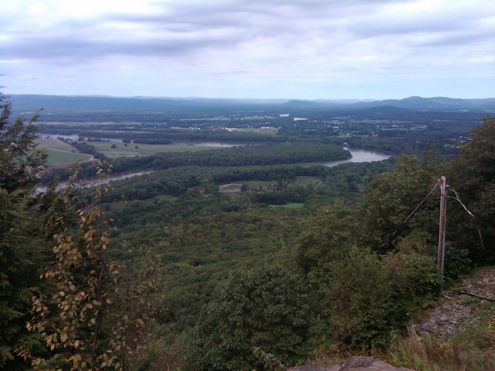
So, I continued on, taking a right at Amherst Road and continuing on. Most of this portion was fairly unassuming. Nothing too big, except, I ran passed lunch time again, so as I made a few mistakes, and had to search for an ATM, I was getting a little cranky. Still, I finally made it to my destination for the day. From the summit (a whopping 932 feet), there was a very nice view of the surrounding area, including the Connecticut River.
![]() |
| This is from the north "face" of Mt. Holyoke |
![]() |
| Another north "face" picture |
![]() |
| Last north "face" picture. That's the Connecticut River running below. |
![]() |
| The next pictures are all from the south "face" |
![]() |
| Summit Cap |
It was an impressive view. I can only imagine how much better the view from Mt. Greylock is. The cool thing about Mt. Holyoke is the access road to the summit. It's a perfect training road for getting used to switchbacks on a bike. I will admit, quite readily, that I have quite a way to go before I can handle the big boy switchbacks that exist elsewhere. Still, it was a lot of fun trying them out. I just have to learn the lines better and not be quite as scared to lean the bike over.
On a sour note, I noticed that the left front foot peg is rather damaged. Rather than try and hobble it together for the trip next weekend, I decided I'd just order some replacement pegs (and pegs that aren't made of bad carbon steel and rubberized plastic). When I got back, I placed and order for a new set of Arlen Ness front foot pegs. Why Arlen Ness? Because I really don't feel like having the foot spikes (they aren't really pegs at that point) and I wanted a set of pegs to match the passenger pegs.
Pictures of the pegs once I get them installed.
All things considered, I hope the ride next weekend goes off without too many bumps. And, despite my earlier trepidation, I would like to see the other riders come along. It'll be fun.
Subscribe to:
Posts (Atom)